

 Download The Latest Version
View Previous Versions
Download The Latest Version
View Previous Versions
Introduction and Review
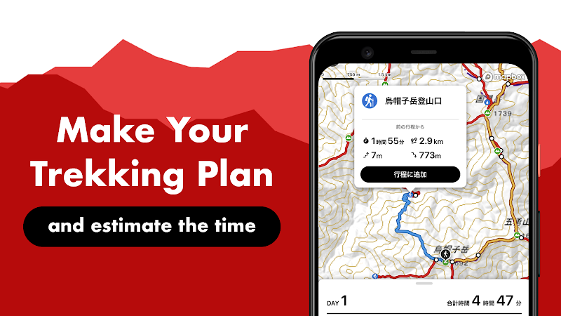
Have you ever been lost and wondered where you are while mountaineering or trekking in the wild? YAMAP, the most popular social GPS outdoor app, will turn that helpless wondering into wanderlust. Designed for outdoor enthusiasts, YAMAP is a mapping app that allows users to pinpoint their current position, even in mountains outside the range of mobile phones, relying solely on GPS signals instead of data connection through the phone’s signals. Normally, professional hikers usually carry special GPS devices or paper maps to confirm their location, but such equipment not only takes up space but is also more expensive. Now, just a smartphone with YAMAP installed can make your outdoor adventure both safe and secure and light. In addition to showing precise locations and recommending suitable routes, it also provides information about the place you may trek, such as altitude, the full distance and the estimation of trekking time. YAMAP’s consideration for the security of its users doesn’t end there yet. The “Course Departure Detection” function in YAMAP allows you to get an early warning if you’re away from the planned course. Not only friendly to mountaineers, whether it is skiing, hiking or canoeing, it is always there to help you create your best adventure. More importantly, YAMAP also provides a social network for its users from all over the world to share outdoor data and have real-time communication. When your outdoor adventure is completed, after regaining Internet accessibility, your logging data will be collected and saved automatically on YAMAP, where you can summarize the data and your experience into a personal journal and share it with your family, friends, as well as mountaineers around the world through the platform. When planning your own adventure, you can also get insight from other adventures for travel advice on YAMAP, for instance, things to watch out for, what kind of outfit to wear, suitable gear to take, and where to find scenic routes and photo opportunities. In this way, users can freely post to share their experiences on YAMAP, leading to extensive interaction and discussion as well as further refinement of your skills. What’s better, the basic features of YAMAP are completely free, but if you want it to be more functional, you can pay for a premium membership. More conveniently, if you have a smart wearable device, such as a Casio Smart Outdoor Watch, all you need to do is install YAMAP Wear on your phone and watch and get it successfully paired, then you can simply use your watch to check the map to get your location when you are outdoors. One thing to note is that having YAMAP on on your smart devices will lead to a power drain because it uses GPS to get your accurate location in real-time. So do make sure you bring charging equipment with you while doing outdoor activities.
Updates
In its latest update of version 10.12.1 on November 9th, 2022, developers have further optimized the user interface of YAMAP. Some of the latest bugs have also been exterminated. According to the update history, YAMAP has been updated basically 4 to 5 times a month to optimize itself for more stable use and fix some bugs. However, there is no specific mention of what exactly has been fixed. The earliest update would date back to version 10.8.7 launched on June 20th, 2022.
Features
1. YAMAP enables outdoor enthusiasts to avoid the trouble of carrying lots of equipment and the risk of accidents by allowing them to pinpoint their location and recommend suitable roads without the need for an Internet connection with just a smartphone.
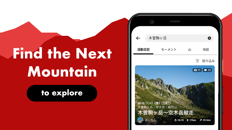
2. It also serves as a source of information platform for outdoor enthusiasts to share their experiences, allowing its users around the world to interact.
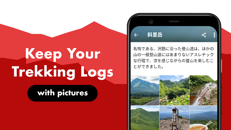
3. After the outdoor activity is finished, users’ data, such as scenic photos taken on the way and your personal route map, will be automatically uploaded when you are able to connect to the Internet, which greatly facilitates users to make personal logs and share them with others directly on YAMAP.


 Get it From Google Play

 Get it From App Store
Download The Latest Version
View Previous Versions
Get it From App Store
Download The Latest Version
View Previous Versions
Similar to This App


ratings

Disclaimer
Get the Apps
Get it From Google Play
Get it From App Store
Download The Latest Version
View Previous Versions
Top Apps


Editor's Choice


Top Games